
Bettles Airport
IATA BTTICAO PABTSmall airfield
Bettles Airport is a small airfield near Bettles in Alaska, United States. It is listed as IATA BTT and ICAO PABT. The airport is located at 66.9139° / -151.5290° at an elevation of 197 m (647 ft). There is one runway, the longest measuring 1,582 m. The nearest airport is Vor Lake Waterlane Seaplane Base, 3.2 km (2 mi) away. The airport is served by scheduled flights.


Data
| IATA code | BTT |
|---|---|
| ICAO code | PABT |
| Local code | BTT |
| Identifier | PABT |
| Type | Small airfield |
| City | Bettles |
| Region | Alaska |
| Country | United States |
| Coordinates | 66.91390, -151.52901 |
| Coordinates (deg/min/sec) | 66° 54′ 50.05″ N 151° 31′ 44.43″ W |
| Elevation | 197 m (647 ft) |
| Scheduled service | yes |
Travel gear that fits
Automatically selected recommendations for a trip to Bettles Airport – based on climate, location and airport type.
 Bettles travel guide
Sights, neighbourhoods and tips for Bettles – ideal for your arrival.
View on Amazon United States travel guide
The overview for your trip: regions, culture, getting around and practical tips for United States.
View on Amazon History & culture: United States
Background knowledge that brings a trip to United States to life.
View on Amazon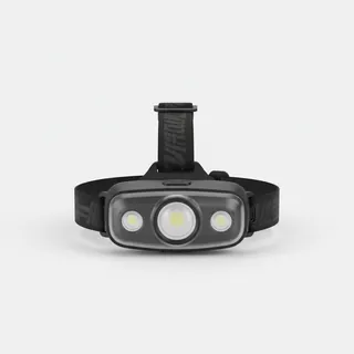 Headlamp
Remote places without street lighting – light on your head helps.
View on Amazon Travel adapter A/B
The destination uses socket types A/B at 120 V – the right adapter keeps everything charged.
View on Amazon Spotting binoculars
Identify registrations and types from the fence – bright and handy.
View on Amazon
Advertising: as an Amazon Associate we earn from qualifying purchases. The price stays the same for you.
Runways
| Runway | Length | Width | Surface | Lighted |
|---|---|---|---|---|
01/19 | 1,582 m | 46 m | Gravel | yes |
Links
Nearby airports
- PPCProspect Creek Airport40 km (25 mi)
- 1AK1Crevice Creek Airport55 km (34 mi)
- AETAllakaket Airport63 km (39 mi)
- CXFColdfoot Airport69 km (43 mi)
- WSMWiseman Airport82 km (51 mi)
- AKPAnaktuvuk Pass Airport136 km (84 mi)
- UTOIndian Mountain LRRS Airport141 km (87 mi)
- WCRChandalar Lake Airport147 km (91 mi)
- US-0272Old Stevens Village Airport148 km (92 mi)
- SVSStevens Village Airport148 km (92 mi)
- 5CDChandalar Shelf Airport153 km (95 mi)
- HUSHughes Airport155 km (97 mi)