
Berlevåg Airport
IATA BVGICAO ENBVMedium airport
Berlevåg Airport is a medium airport near Berlevåg in Finnmark, Norway. It is listed as IATA BVG and ICAO ENBV. The airport is located at 70.8715° / 29.0341° at an elevation of 13 m (42 ft). There is one runway, the longest measuring 1,028 m. The nearest airport is Gamvik Airport, 37 km (23 mi) away. The airport is served by scheduled flights.


Data
| IATA code | BVG |
|---|---|
| ICAO code | ENBV |
| Identifier | ENBV |
| Type | Medium airport |
| City | Berlevåg |
| Region | Finnmark |
| Country | Norway |
| Coordinates | 70.87152, 29.03410 |
| Coordinates (deg/min/sec) | 70° 52′ 17.46″ N 29° 02′ 02.75″ E |
| Elevation | 13 m (42 ft) |
| Scheduled service | yes |
Travel gear that fits
Automatically selected recommendations for a trip to Berlevåg Airport – based on climate, location and airport type.
 Berlevåg travel guide
Sights, neighbourhoods and tips for Berlevåg – ideal for your arrival.
View on Amazon Norway travel guide
The overview for your trip: regions, culture, getting around and practical tips for Norway.
View on Amazon Norwegian phrasebook
The essential phrases in Norwegian – for taxis, hotels and restaurants.
View on Amazon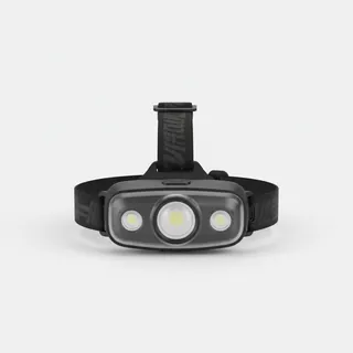 Headlamp
Remote places without street lighting – light on your head helps.
View on Amazon Noise-cancelling headphones
Shut out cabin noise and terminal announcements – the classic for frequent flyers.
View on Amazon Carry-on trolley
Hard-shell case in standard cabin size – fits the overhead bins of most scheduled flights.
View on Amazon
Advertising: as an Amazon Associate we earn from qualifying purchases. The price stays the same for you.
Runways
| Runway | Length | Width | Surface | Lighted |
|---|---|---|---|---|
06/24 | 1,028 m | 30 m | Asphalt | yes |
Links
Nearby airports
- BJFBåtsfjord Airport39 km (24 mi)
- MEHMehamn Airport47 km (29 mi)
- NO-0038Masjok Airstrip75 km (47 mi)
- NO-0081Tana Bru Heliport81 km (50 mi)
- VAWVardø Airport, Svartnes94 km (58 mi)
- VDSVadsø Airport95 km (59 mi)
- HVGHonningsvåg Airport, Valan112 km (69 mi)
- KKNKirkenes Airport, Høybuktmoen131 km (82 mi)
- RU-10088Nikel Heliport168 km (104 mi)
- RU-7444Koshka Yavr Air Base198 km (123 mi)
- NO-0078Maggi Beach Airstrip207 km (129 mi)
- RU-1045Guba Ara Submarine Base Helipad218 km (135 mi)