
Red Dog Airport
IATA RDBICAO PADGSmall airfield
Red Dog Airport is a small airfield near Red Dog in Alaska, United States. It is listed as IATA RDB and ICAO PADG. The airport is located at 68.0321° / -162.8990° at an elevation of 295 m (969 ft). There is one runway, the longest measuring 1,924 m. The nearest airport is Noatak Airport, 53 km (33 mi) away. No scheduled service is recorded for this airfield.


Data
| IATA code | RDB |
|---|---|
| ICAO code | PADG |
| Local code | DGG |
| Identifier | PADG |
| Type | Small airfield |
| City | Red Dog |
| Region | Alaska |
| Country | United States |
| Coordinates | 68.03210, -162.89900 |
| Coordinates (deg/min/sec) | 68° 01′ 55.55″ N 162° 53′ 56.41″ W |
| Elevation | 295 m (969 ft) |
| Scheduled service | no |
Travel gear that fits
Automatically selected recommendations for a trip to Red Dog Airport – based on climate, location and airport type.
 Alaska travel guide
Routes, towns and day trips across Alaska.
View on Amazon- United States travel guide
The overview for your trip: regions, culture, getting around and practical tips for United States.
View on Amazon  United States road map
A printed map for planning – works without signal or battery.
View on Amazon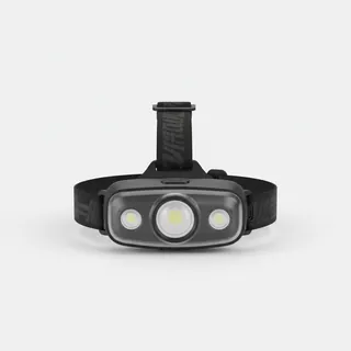 Headlamp
Remote places without street lighting – light on your head helps.
View on Amazon Travel adapter A/B
The destination uses socket types A/B at 120 V – the right adapter keeps everything charged.
View on Amazon Thermal base layer
Cold destination: merino keeps you warm even when damp.
View on Amazon
Advertising: as an Amazon Associate we earn from qualifying purchases. The price stays the same for you.
Runways
| Runway | Length | Width | Surface | Lighted |
|---|---|---|---|---|
03/21 | 1,924 m | 30 m | Asphalt | no |
Links
Nearby airports
- WTKNoatak Airport52 km (33 mi)
- KVLKivalina Airport77 km (48 mi)
- OTZRalph Wien Memorial Airport128 km (80 mi)
- ORVRobert (Bob) Curtis Memorial Airport157 km (98 mi)
- IANBob Baker Memorial Airport157 km (98 mi)
- 8AK3Roland Norton Memorial Airstrip183 km (114 mi)
- PIZPoint Lay LRRS Airport189 km (118 mi)
- DRGDeering Airport218 km (136 mi)
- 4Z2Upper Hannum Creek Airport237 km (147 mi)
- CDLCandle 2 Airport240 km (149 mi)
- BKCBuckland Airport240 km (149 mi)